An Information and Consultation Process on Protected Areas in Nunavik
In 2020, in Nunavik, new territories were added to the Register of protected areas in Quebec [available only in French as Registre des aires protégées au Québec]. They cover a total area of approximately 29,800 km². Before these areas obtain permanent and official protection status, an extensive public information and consultation process is undertaken in Nunavik. This project is strongly rooted in the consultation process for the planning and creation of Nunavik protected areas, undertaken with all communities concerned in 2011–2012.
This process is again led by the Kativik Regional Government (KRG), as land use planner, in partnership with the Advisory Committee to the Nunavik Protected Areas Working Group (PAWG). Its purpose is to ensure that all Nunavik communities and Nations are informed and have a voice in the process that led to the current definition of the protected areas network, its relevance, and its representativeness.
Ultimately, the aspirations of Nunavik communities and Nations for the future of each of the protected areas will be examined, as well as the means to ensure the development and vitality of the network.
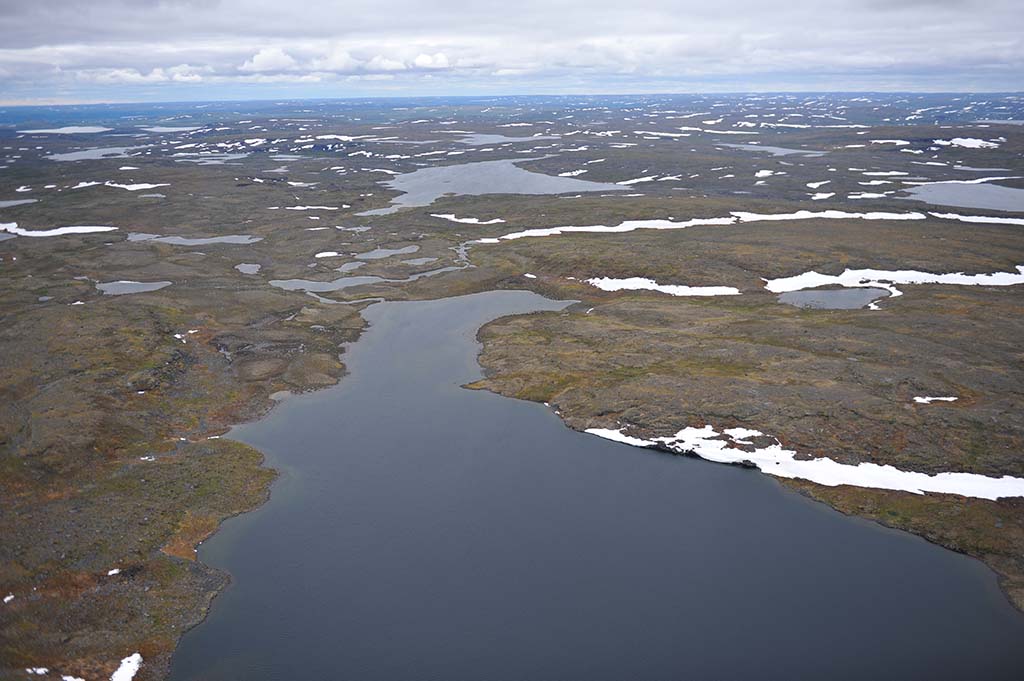
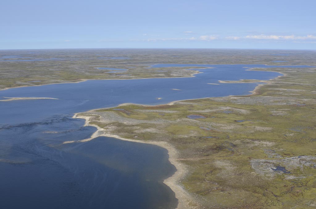
 © Camille Le Gall-Payne, KRG/ARK")
Which protected areas are involved?
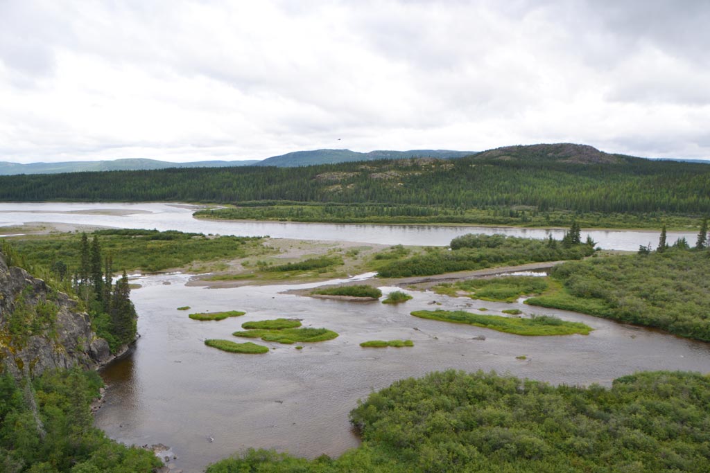
 © Catherine Pinard, KRG/ARK")
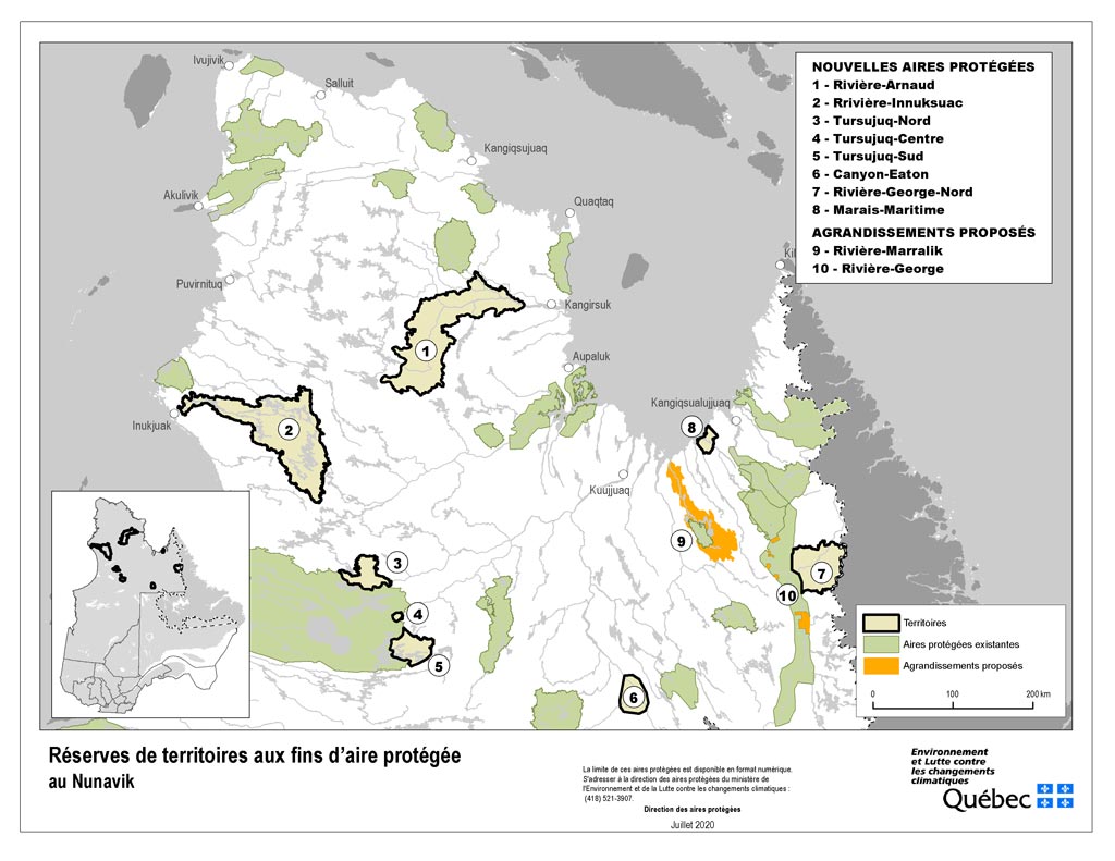
Proposed Biodiversity Reserves and Proposed Aquatic Reserve
In Nunavik, 8 biodiversity reserves and 1 aquatic reserve have “proposed” status, even though they are part of the existing network of protected areas and are listed in the Registre des aires protégées au Québec. This provisional status, which has been in effect for several years, shows that the process is underway. In the end, the protected areas concerned will obtain the official and permanent status of biodiversity reserve or aquatic reserve.
 © Marianne Ricard, KRG/ARK")
Territorial Reserves for Protected Area Purposes
Nunavik’s protected areas network was recently enhanced by the addition of 8 new Territorial reserves for protected area purposes (TRPAs) and the expansion of 2 existing ones. There is also 1 TRPAP designated prior to the new 2020 announcements. This status allows for the temporary suspension of the granting of mining titles and of any authorization related to mining exploration, as well as any energy or forestry development activity. The goal is for all of these TRPAPs to obtain permanent biodiversity reserve status.
“We need economic development for our kids, but let’s talk about protecting the really important areas for our food – like the Kovik River and the coast – so we can have jobs and still eat our country food.”
Participant in the 2011–2012 protected areas consultations
Who are the people involved?
The communities of Nunavik
In Nunavik, each Inuk, Naskapi and Cree is is an important actor in the planning process of the protected areas network. The Inuit Nation, along with the Naskapi Nation of Kawawachikamach and the Cree Nation of Whapmagoostui, are at the heart of the process.
The Nunavik Protected Areas Working Group (PAWG)
The Nunavik PAWG, created in 2013, follows up on the recommendations of the 2011–2012 community consultations on the creation of the Nunavik protected areas network. It is composed of representatives from the following organizations:
- Kativik Regional Government (KRG)
- Ministère de l’Environnement et de la Lutte contre les changements climatiques, de la Faune et des Parcs (MELCCFP)
- Ministère des Ressources naturelles et des Forêts (MRNF)
- Ministère de l’Économie, de l’Innovation et de l’Énergie (MEIE)
- Société du Plan Nord (SPN)
The Advisory Committee to the PAWG
The Advisory Committee, created in 2017, ensures information sharing and validation of the PAWG’s work on protected area planning. It is composed of representatives from the following organizations:
- Kativik Regional Government (KRG)
- Makivik Corporation (Makivvik)
- Cree Nation Government
- Naskapi Nation of Kawawachikamach
- Ministère de l’Environnement et de la Lutte contre les changements climatiques, de la Faune et des Parcs (MELCCFP)
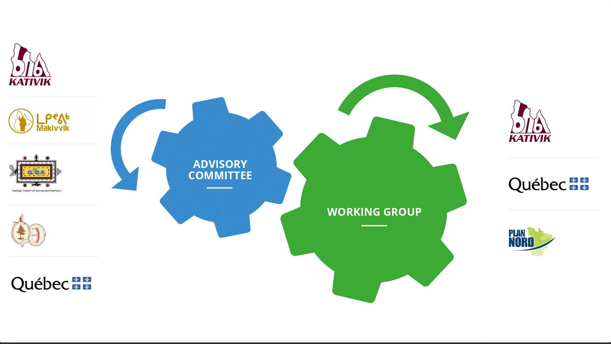
Tap on the diagram to enlarge it.
Progress made so far
1998: Master Plan for Land Use in the Kativik Region
2008–2009: 11 protected area proposals
The Government of Quebec submitted 11 protected area proposals to the Kativik Regional Government (KRG) and the Makivik Corporation::
- 8 proposed biodiversity reserves
- 3 territorial reserves for protected area purposes
The KRG and the Makivik Corporation agreed to consider these proposals, subject to community consultations in Nunavik and the opportunity to submit their own proposals.
Quebec's network of protected areas now covers 8.12% of Quebec's land area.
2011: Announcement of the Plan Nord and the Plan Nunavik
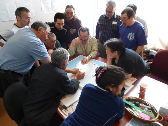
2011–2012: Community consultations on protected areas in Nunavik
One of the important insights emerging from these consultations is that people and the land are in a relationship of interdependence, adaptation, and resilience. This relationship is the key to a healthy future. As custodians of the past, present, and future use of the territory, the communities and Nations of Nunavik have a strong sense of responsibility to maintain the integrity of the territory and to pass on the knowledge and skills associated with it.
As a result of these consultations: :
- 6 proposed biodiversity reserves and 3 territorial reserves for protected area purposes were approved with amendments and listed in the Registre des aires protégées :
- Réserve de biodiversité projetée des Drumlins-du-Lac-Viennaux
- Réserve de biodiversité projetée de l’Estuaire-des-Rivières-Koktac-et-Nauberakvik
- Réserve de biodiversité projetée du Fjord-Tursukattaq
- Réserve de biodiversité projetée de Kangiqsujuaq
- Réserve de biodiversité projetée de Quaqtaq-Kangirsuk
- Réserve de biodiversité projetée de la Rivière-Delay
- Réserve de territoire aux fins d’aire protégée du Lac-Jeannin
- Réserve de territoire aux fins d’aire protégée de la Rivière-Marralik
- Réserve de territoire aux fins d’aire protégée de la Rivière-George
- 2 proposed biodiversity reserves without the support of local and regional authorities in Nunavik were listed in the Registre des aires protégées au Québec:
- Réserve de biodiversité projetée de la Rivière-Vachon
- Réserve de biodiversité projetée du Lac-Sérigny.
- New proposals were submitted by the regional authorities. None of these proposals were accepted by the Ministère de l'Environnement at the time, but these territories were included in a database for the next stage of protected area creation.
- A consensus emerged that the Kovik River and its watershed should be a priority for conservation.
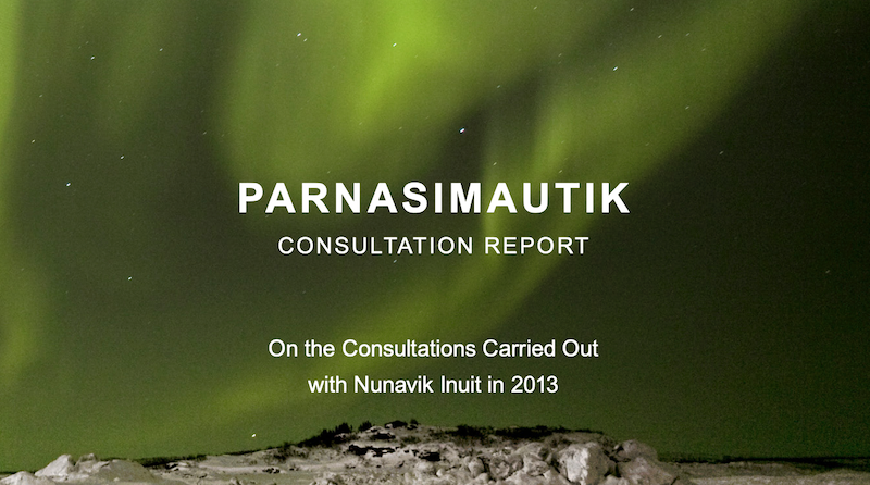
2012–2014: Parnasimautik Initiative
2012: Announcement of the target to protect 20% of the territory of Nunavik
2013: Creation of the Nunavik Protected Areas Working Group
The Nunavik Protected Areas Working Group (PAWG) was formed with representatives from the following organizations:
- Kativik Regional Government (KRG)
- Ministère de l’Environnement et de la Lutte contre les changements climatiques (MELCC)
- Ministère de l’Énergie et des Resources naturelles (MERN)
- Ministère des Forêts, de la Faune et des Parcs (MFFP)
- Société du Plan Nord (SPN)
- The Makivik Corporation withdrew from the Working Group in 2017 to sit on the Advisory Committee instead.
2016: Incorporation of 40 protected area proposals into a database
2017: Establishment of an Advisory Committee and a prioritization exercise leading to 9 protected areas agreed to by consensus.
In 2017, an Advisory Committee was created to provide recommendations and advice to the PAWG. It was formed with representatives from the following organizations:
- Kativik Regional Government (KRG)
- Makivik Corporation
- Naskapi Nation of Kawawachikamach
- Cree Nation Government
- Ministère de l’Environnement et de la Lutte contre les changements climatiques (MELCC)
Prioritization tools for the 40 proposals were also developed in 2017 by each of the PAWG members. For its part, the Advisory Committee developed an objective tool that integrates “the cultural and social values of Indigenous communities.” It is composed of 3 components: cultural use, conservation, and development. A scoring system for the criteria included in each component allows the proposals to be prioritized.
Following this objective prioritization exercise, stakeholders had high-level qualitative and political discussions that resulted in consensus on 9 protected areas:
- Réserve de territoire aux fins d'aire protégée de la Rivière-Innuksuac
- Réserve de territoire aux fins d'aire protégée de la Rivière-Arnaud
- Réserve de territoire aux fins d'aire protégée de Tursujuq-Nord
- Réserve de territoire aux fins d'aire protégée de Tursujuq-Centre
- Réserve de territoire aux fins d'aire protégée de Tursujuq-Sud
- Réserve de territoire aux fins d'aire protégée du Canyon-Eaton
- Réserve de territoire aux fins d'aire protégée du Marais-Maritime
- Réserve de territoire aux fins d'aire protégée de la Rivière-George-Nord
- Réserve de territoire aux fins d’aire protégée de la Rivière-Marralik
2018: Provisional protection status obtained
2019: Signing of the Specific Agreement to Preserve the Cambrien Lake/Nachicapau Lake/Fort Mackenzie (Waskaikinis) Area
2020: Additions to the Registre des aires protégées au Québec and achievement of the 20% target
In 2020, the new territorial reserves for protected area purposes (TRPAPs) were formally incorporated into the Registre des aires protégées au Québec along with two expansions—to the Marralik River TRPAP and the George River TRPAP.
Results
- The Réserve aquatique projetée de la Rivière-Kovik was added to the Registre in 2018.
- 8 new protected area proposals:
- Réserve de territoire aux fins d’aire protégée de la Rivière-Innuksuac
- Réserve de territoire aux fins d’aire protégée de la Rivière-Arnaud
- Réserve de territoire aux fins d’aire protégée de Tursujuq-Nord
- Réserve de territoire aux fins d’aire protégée de Tursujuq-Centre
- Réserve de territoire aux fins d’aire protégée de Tursujuq-Sud
- Réserve de territoire aux fins d’aire protégée du Canyon-Eaton
- Réserve de territoire aux fins d’aire protégée du Marais-Maritime
- Réserve de territoire aux fins d’aire protégée de la Rivière-George-Nord
- 2 TRPAP expansions
- Réserve de territoire aux fins d’aire protégée de la Rivière-Marralik
- Réserve de territoire aux fins d’aire protégée de la Rivière-George
The protected area network covers 20.59% of Nunavik's surface area.
2021: Revision of the Natural Heritage Conservation Act
What is a protected area in Nunavik?
For the Quebec government, nature conservation through protected areas implies, “…the safeguarding of representative samples of all biological diversity.” It is thus a matter of “ensuring the protection of representative territories of particular ecosystems which, across the network, will cover all ecosystem types in Quebec.”
“[…] Thus, a biodiversity reserve or aquatic reserve may protect a common, representative ecosystem that may sometimes seem unremarkable in terms of biological diversity or unspectacular in terms of landscape. However, all ecosystems and elements of the natural environment, even the most common in Quebec, must be protected and be part of the Quebec network of protected areas.”
In Nunavik, the cultural dimension is also essential in the process of creating protected areas. It has been integrated along with the conservation and development dimensions. Consultation with regional stakeholders is also a key aspect of this process.
The rights of the beneficiaries of the James Bay and Northern Quebec Agreement (JBNQA) and the Northeastern Quebec Agreement (NEQA) are maintained and protected within the protected areas of Nunavik.
Why and how will the Inuit, the Naskapis and the Crees be consulted?
The new rounds of consultation will allow the Inuit, the Naskapis of Kawawachikamach, and the Crees of Whapmagoostui to share their views on the creation of the protected areas, on the process that led to the current results, and on the relevance and representativeness of the network as it is presented on this website.
Public consultations are planned to be held in all Nunavik communities in the fall of 2022, depending on the health situation (COVID-19).
What happens at the end of the consultations will depend on what is expressed by the communities.
What are or what will be the various planning tools implemented for each protected area?
Conservation plans will be drafted for each protected area. Management plans could also be developed in collaboration with various partners (communities, regional organizations, etc.).